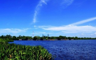
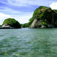
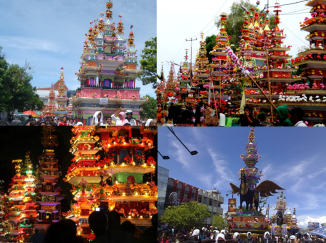
Welcome our 34th province: North Kalimantan…

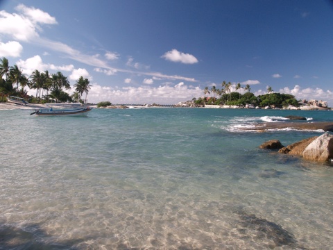
Nunukan crystal water sea

***

Official Name : Kalimantan Utara ( abbreviation : Kaltara)

Origin of Name : North Borneo is long associated with northern part of Borneo, which historically was British occupied areas of Sarawak, Sabah, Labuan (of Malaysia) & tiny Brunei Darussalam sultanate. But, another ‘North Borneo’ is now created. What used to be northern parts of ‘East Kalimantan’ province is eventually made up a brand new province, the 34th province of the Republic of Indonesia: KALIMANTAN UTARA (North Kalimantan) or ‘Kaltara’ for short.

History :  The coastal region was dominated by Berau Kingdom before finally splitted off into Bulungan and Tidung Kingdom.  Bulungan is vazal of Brunei Kingdom, whilst Tidung has inter-marriage relationship with Sulu Sultanate that also dominated the upper north. Somehow the Dutch Indies had included them under its teritorry apart from what British Indies did with Sabah.

From 1960s these areas belong to East Kalimantan Province until 2012, after The DPR-RI (Dewan Perwakilan Rakyat Republik Indonesia) or The House of Representative and the government have officially endorsed the establishment of North Kalimantan as the nation’s 34th province on Thursday, 25 October 2012, ceded from the upper north of East Kalimantan Province.

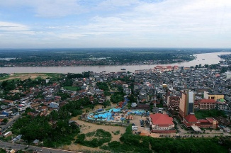
The capital city is not yet decided, but rumor has it, they won’t follow Jakarta or many other provinces which have the capital city as both seat of administration and commercial/industry. Rather, they’d like to follow KL’s pattern on separate those function (which locate administrations offices in Putra Jaya, some few kms away from downtown KL).  So, Nunukan City as well as Tarakan City might as well as the commercial hubs for newly created province, but the capital city is planned to be in Tanjung Selor (a relatively small town yet convenience, located in the heart of Bulungan regency).

The province itself is a long answer to the creation of Indonesian windows in the borderline. A more attention to the welfare and prosperity of our citizens that live along the borders with other country.  With the endorsement on Thursday, Indonesia has 529 autonomous regions, comprising 34 provinces, 402 regencies and 93 municipalities The news from The Jakarta Post

Founded :  20 Oktober 2012

Legality : UU No.20 / 2012

Location : Northern part of  East Kalimantan province, borders with Sabah ( Tawau, Nabawan & Sipitang) & Sarawak ( Kapit, Limbang & Miri ) in the north; and East Kalimantan ( West Kutai, Kutai Kartanegara, East Kutai & Berau ) in the south.

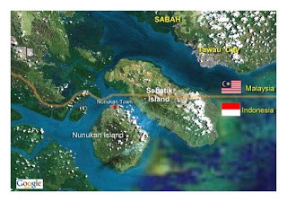
The province also shares Sebatik Island (in Nunukan Regency) with Sabah, Malaysia. Even a house in the island has a livingroom in Indonesia and its kitchen is in Malaysia as it stands just across the borderline.

nunukan_map-google-sat

Capital :  Tanjung Selor (  as of now the city has double functions as the capital city of Bulungan Regency as well as the capital of the brand new created province )

Population :  738,163  / Area : 72.567.49 km2

Province Seal :  / Motto : –not yet–

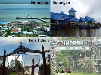
Administrative divisions : North Kalimantan consists of 4 regencies and 1 city as seen in the map below (yellow) and its previous province East Kalimantan (in white) : KALTARA PETA NORTH KALIMANTAN MAP
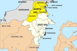
1. Tarakan City

2. Bulungan ( Tanjung Selor )

3. Nunukan ( Nunukan City )

4. Malinau ( Malinau City )

5. Tana Tidung ( Tideng Pale )

Zip Code : 77xxx   / Phone Code :    0551 ( Tarakan ); 0552 ( Tg.Selor/Bulungan & Tana Tidung ); 0553 ( Malinau ); 0556 (Nunukan) / Vehicle Plate : KT ( same as East Kalimantan )

University : Universitas Kalimantan Utara (Tarakan) ; Borneo University (Tarakan)

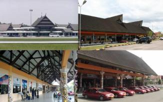
Airport : Biggest airport to reach North Kalimantan is through Juwata Intl. Airport, Tarakan City (TRK) ; The province also has several small airports (lapangan terbang perintis) : Nunukan Airport (NNX) Nunukan town ; Long Bawan/Yuvai Semaring Airport (Krayan, Nunukan) ; Bunyu Airport (BNQ) Pulau Bunyu, Bulungan ; Banaina Airport (NAF) Bulungan ; Tg Harapan Airport (TJS) Tg Selor, Bulungan ; Malinau Airport (MLN) Malinau town ; Long Ampung Airport (LPU) Kayan Selatan, Malinau.

juwata airport

Oil City Tarakan is served by Juwata International Airport

Provincial Flora & Fauna : -na-

Ethnics of origin: Tidung, Bulungan, Dayak (Kenyah), Berau, Suluk (Tausug), Banjar

Food:

Folksong: Bebilin; Andang Sigurandang ( Tidung ) ; Sulai Mambeng, Dindeng Sayeng (Bulungan)

Dance/Musical art: Tingkilan ensemble ; Jepen

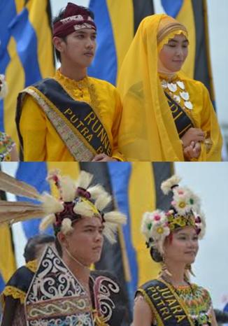
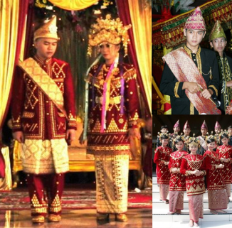
Traditional Clothes:
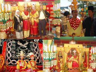
tidung brideTidung tribe traditional costume (marriage)

coastal-dayak

Coastal-Malay Bulungan Traditional outfit (above) – Hinterland Dayak costume (below)

Traditional weapon : Mandau, Sumpit (Dayak);  Keris (Bulungan/Tidung)

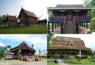
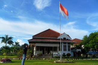
Traditional house : Three major cultures that dominate North Kalimantan are of the sultanate (Bulungan), the coastal people (Tidungs) and the hinterland (dayaks). It also reflects province’s traditional houses. Lubung_Intamu.jpeg
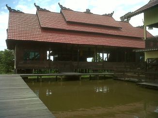
Lubung Intanu of  Tidung tribes’ Rumah Baloy (Tarakan City)
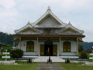
istana sultan bulunganPalace (now a museum) of Sultan Bulungan in Tanjung Palas
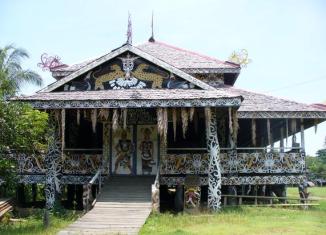
setulangDayak traditional house (Setulang, Malinau)

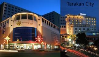
Downtown & Mall : pics

North Kalimantan regencies

trkn cty mall

Port : Tanon Taka Seaport, Nunukan Town.

Nunukan seaport 1

Rivers :  Mountain & Natural :

National Park/Ocean Park : Kayan Mentarang Natl. Park (1,35 million hectare, Bulungan-Nunukan-Malinau)

Bridge & Dam : 

Places of Interest : 

* Nunukan Sea Resorts

*Birau Cultural Festival ( annually – Tarakan City ) showcased all cultural elements of the province (Bulungan, Tidung & Dayak) and other ethnics that live in the province.

*Dayak Festival Malinau

*Historical Tourism, including :  Bulungan Royal Palace (museum) in Tg.Palas, Bulungan. *Adventure Tourism : Dayak village and forest/river trek

Photo Credits: Imanrabinata.blogspot.com ; Sudewi2000.wordpress.com ;

TRIVIA : UNUSUAL CITY

Barelang Bridge (consists of 6 bridges : Tengku Fisabilillah – Nara Singa – Raja Ali Haji – Sultan Zainal Abidin – Tuanku Tambusai – Raja Kechik)  Batam City, Riau Archipelago Province

***

Indonesia is blessed with more than seventeen thousand islands, stretching more than 1,900,000 km2 along the equator line. And with more than 230 million people speak approximately 400 various indegenous languages, this archipelago is unquestionable bear the most dynamic country on earth.

Administratively, Indonesia is consisting of  33 provinces (a relatively few, comparing to Thailand’s 76 and Philippine’s 80) but then each provinces are consisted of regencies and cities (as of 2012 there are 405 regencies and 97 cities, or 502 in total). Regency and City are the same administration level, having their own local government and legislative body.

What difference does it make between ‘Regency (Kabupaten) and City (Kota)’?

Broadly speaking, the difference lies in demography, size and economy. Generally, a regency comprises a rural, larger area than a city. A city usually has non-agricultural economic activities. Other than that, a regency is headed by a regent (bupati), while a city headed by a mayor (walikota). All regents, mayors and member of representatives are directly elected for five years term.

Somehow it’s not always necessarily be that way. We noted  ‘city’ that goes beyond the ‘usual and common idea or definition about a city’… due to its location or natural reasons. Here are the list:

1. KOTA BATAM, Riau Archipelago (Kepulauan Riau) Province

batam

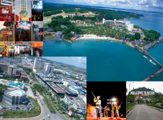
Most people will instantly picture this –when Batam is mentioned– : an island-city lies only a few miles away from another island-city neighbour Singapore. And they can’t be blamed for this.

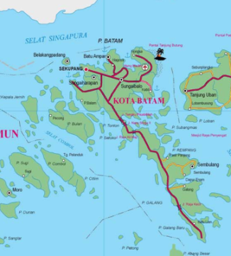
batam cityBut the truth is, Batam city comprises more than one single island.  If we are to see from the above (see the map), we’ll spot many islands with ‘ Rempang ‘ and ‘ Galang ‘ next to Batam. This three islands are now connected with 6 grand bridges collectively called   ‘Jembatan Barelang’ ( stands for BA-tam ~ RE-mpang ~ ga-LANG ). *picture above*

Even then, as much commercially or industrial  it can be, Batam can never fit definition above, since Rempang & Galang is literally rural. And with 715 km2 area that Batam City covers, there are many isles nearby such as Belakang Padang, Bulan, Subang Mas and several others almost of them are also rural – even uninhibitted- Batam city is easily placed amongst unusual city, in the sense that it has quiet wide area for a city and that it holds both urban-suburban-rural environments.

batam

Batam is a free trade zone, it has to compete with Singapore and Johore for the ‘Si-Jo-Ri’ development area (Singapore-Johore-Riau), thus it should have many islands to grow in the future. This is the reason why Batam City covers beyond Batam Island itself but also to many adjacent islands.

Enjoy Batam

More : Kepulauan Riau Province

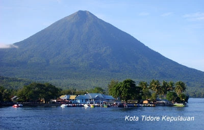
2. KOTA TIDORE KEPULAUAN, North Maluku Province

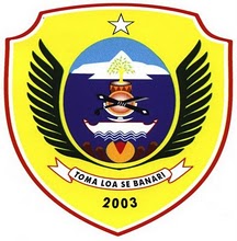
Lambang_Kota_Tidore_Kepulauan

The official name of the city – Kota Tidore Kepulauan (literally City of Tidore Islands) – easily figures out what anomali the city has.  This probably almost the same with Batam City that it has wide enough area for a city status and covering more than one island.

It is true, with coverage area of 9.564,7 km² , the city is ranked first based on . and had an Census population of 89,506 in 2010, the mainland part (Oba) became the city of Sofifi, the new provincial capital. 

tidore map peta

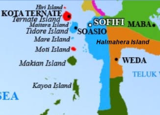
City of Tidore Islands area (in blue) consists of Tidore Island, Mare & Maitara Island and also western part of Central Halmahera Island.  

The municipality covers 2 small islands, Maitara and Mare, Oba and Tidore island. It is divided into 5 sub-districts (kecamatan), namely Oba, Oba Utara, Tidore, Tidore East, South Tidore, and North Tidore. The 4 Tidores cover Tidore Island and the two small islands, covering .

3. KOTA PADANG SIDEMPUAN

Jakarta Special Capital Region

Official Name : Daerah Khusus Ibukota Jakarta Raya (Abbreviation: DKI Jaya / JKT) ;

Origin of Name : The name Jakarta was not known until 1527 when Fatahillah from Demak & Cirebon Sultanates victoriously took the city of ‘Sunda Kelapa’ from Portuguese and change the name to ‘Jayakarta’ (Victorious City). Various name that linked to Jakarta are :  Sunda Kelapa (prior 1527),  Jayakarta (15271619), Batavia/ Batauia,  or Jaccatra/ Xacatra (1619-1942), and Djakarta (1942-1972).

HistoryJakarta was first mentioned in the historical records in the 4th century, when it was a Hindu settlement and port. Ever since, the city had been variously claimed by the Indianized kingdom of Tarumanegara, the Hindu Kingdom of Sunda, the Muslim Sultanate of Banten, the Dutch East Indies, the Empire of Japan, and finally Indonesia. More…..

Founded : 22 June 1527

Location : Java Island; borders with Banten & West Java Provinces

Capital : —

Pop: 9.607.707 (1st )/ Area: 740,3 km2 (34th-the smallest in the nation)

Province Seal : Blue & yellow dominates the seal, with National Monument (Tugu Monumen Nasional) as its centerview. Rice and cotton; ocean waves below and Masjid dome above. The province’s motto is writen atop.

Motto : JAYA RAYA (Victorious – Great)


Administrative Divisions: 5 Kotamadya (Cities) 

1. KOTAMADYA JAKARTA PUSAT/Central Jakarta

2. KOTAMADYA JAKARTA BARAT/West Jakarta

3. KOTAMADYA JAKARTA SELATAN/South Jakarta

4. KOTAMADYA JAKARTA TIMUR/East Jakarta

5. KOTAMADYA JAKARTA UTARA/North Jakarta

& 1 Daerah Administratif (Administrative region) : JAKARTA KEPULAUAN SERIBU/Thousands Island.

The islands of the Thousand Islands is a regency which belongs to the city of Jakarta. This makes Jakarta the only capital city in the world which contains more than 100 islands since in the official list, the Thousand Islands Regency contains 110 islands. It also serves as a marine national park (Taman Nasional Laut Kepulauan Seribu), where sea turtles are conserved. Located 45 km north of Jakarta. The complex contains 342 reef platforms, with 110 formes an island larger than half an acre. There may be as many as 700 individual reefs in the complex.

The cities and regencies that border DKI Jakarta are now called  ‘Ja-Bo-De-Ta-Bek‘ (-abbreviation of Jakarta and 4 other cities: Bogor & Depok Cities of West Java Province, Tangerang & Tangerang Selatan Cities of Banten Province and Bekasi City of West Java Province), a megapolitan city they’ve become, covering more than  661 km2

ZIP Code :70-72xxx/ Phone Code: 021

State University: University of Indonesia (UI) Salemba campus, Central Jakarta (however main campus is located in suburban area of Depok City/West Java Province, an outskirt of DKI Jakarta itself); Universitas Negeri Jakarta (UNJ) in Rawamangun, East Jakarta; Universitas Islam Negeri Jakarta ‘Syarif Hidayatullah’ (UINJ).

Airports: Halim Perdana Kusumah Airport (private/state used only) in Cipinang Melayu/Halim area, East Jakarta. While Sukarno-Hatta International Airport is located in Cengkareng, Tangerang, Banten Province.

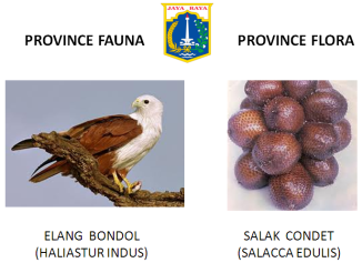
Province Fauna/Floral:

Ethnic/Language of Origin:Betawi/ Bahasa (Melayu) Betawi – the dalam & the pinggir dialects.

Food: Snack/Cake: Dodol Betawi, Kembang Goyang, Kerak Telor. Soup: Soto Betawi, Laksa Betawi, Asinan Betawi. Rice: Nasi Uduk, Nasi Briyani, Nasi Kebuli.

Folksong: Kicir-Kicir; Jali-Jali; Sirih Kuning; Langgam Betawi; Keroncong Tugu (a mestizo art of local/Malay with Portuguese descendants)  Dance-art:  Tandak Betawi, Tari topeng Betawi, Zafin

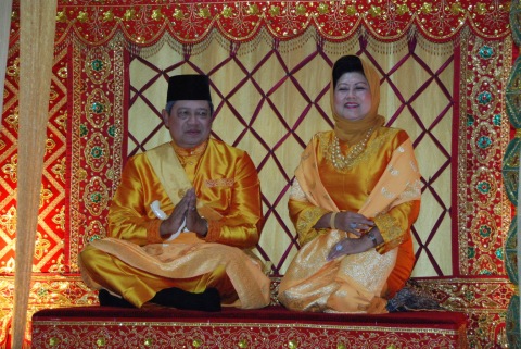
Traditional Clothes: There are at least four main traditional costumes of Betawi, two of them are ‘The Wedding Clothes (Baju Pengantin) & Baju Demang (usually for the elder or the head of village)’. The dress below shows Betawi’s open  culture that twist local culture (Malay) with Arabic (Hadramouti), Chinese and coastal Javanese. Baju pengantin for groom is called -‘Dandan care Haji’ or ‘dress like a hajj pilgrim’ consist of Arabic’s Hadramouti gamis or ‘Jubah/Jube’  completed with surban for headdres. The bride represents ‘chinese princess’ and is called ‘Dandan gaye Putri Cine’ completed with Kebaya ( Kun ), widen yuang dress ( Tuaki ), chest cover ( Tearatai/ Delime ), with shoe: alas kaki selop tutup perahu kotek. For headdress, consist of siangko with face cover (cadar) completed with 4 pieces of burung hong birds, kembang rumput, kembang goyang and other variants.     Baju Demang is a formal dress for older person or special occasion. It represents the westernised baju teluk belanga, (below)

And for the youngster are ‘Baju Abang None’ (consist of ‘Abang/male’ who wears a long gamis -Indian style- with Javanese/Sundanese cap in Betawi batik; while ‘Nona/female’ dress is colorful long kebaya with contrast kain tudung/hijab). Other than that is a more informal dress called ‘Baju Kadariah’ where the male wears -usually- white baju koko with Javanese batik trouser and kopiah (Indonesian cap), the female wears short colorful kebaya encim (coastal kebaya) with kain batik Betawi. (below)  

Traditional weapon : Gobang, Parang, Golok

Traditional house : Rumah Betawi

Downtown & Malls:


Port : Pelabuhan Sunda Kelapa & Tanjung Priok

Rivers, Mountain & Natural : Ciliwung, Cipinang, Sunter, Kalideres, Kalimalang

National Park/Ocean Park : Kepulauan Seribu Ocean Park & Muara Angke National Park

Bridge & Dam : —

Places of Interest :  *Historical Tourism, including : *Religious Tourism, including :  *Adventure Tourism : *Shopping Tourism :

Visit : Pics of Provincial Capitol & Landmarks (click here):

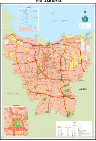
Official Map:

Credit pics : abnonjakpus.org – sewabusanabetawi.com

JAMBI Province

riverside batanghari

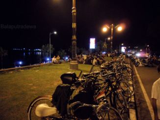
Night scene along Batanghari Riverside, Tanggo Rajo (lit. means ‘King’s ladder) Jambi City 

Official Name : Jambi

Origin of Name: According to local legend, the word ‘Jambi’ is related to the word ‘Pinang’ (battlenut). It was told that the area alongside Batanghari river was controlled by a queen named ‘Puteri Selaras Pinang Masak’. During the engagement with the Javanese kingdom of Majapahit, the influence of Javanese court language was absorbed, including the word ‘pinang’ (battlenut) which was called ‘Jambe’ in Javanese.

Other version said, that most likely when Datuk Orang Kayo Hitam tried to pick the land for the construction site of the new kingdom (in locals called  ‘Tanah Pilih Pesako Bertuah’), he chose a land that were grown by battlenuts along the Batang Hari river. Accordingly, its new name of the sultanate was called “Jambe” means “battlenut”.

History: Jambi was the site of the Srivijayan kingdom that engaged in trade throughout the Strait of Malacca and beyond. Jambi succeeded Palembang, its southern economic and military rival, as the capital of the kingdom. The movement of the capital to Jambi was partly induced by the 1025 raid by pirates from the Chola region of southern India, which destroyed much of Palembang. In the early decades of the Dutch presence in the region, when the Dutch were one of several traders competing with the British, Chinese, Arabs, and Malays, the Jambi sultanate profited from trade in pepper with the Dutch. This relationship declined by about 1770, and the sultanate had little contact with the Dutch for about sixty years.

In 1833, minor conflicts with the Dutch (the Indonesian colonial possessions of which were now nationalised as the Dutch East Indies) who were well established in Palembang, meant the Dutch increasingly felt the need to control the actions of Jambi. They coerced Sultan Facharudin to agree to greater Dutch presence in the region and control over trade, although the sultanate remained nominally independent. In 1858 the Dutch, apparently concerned over the risk of competition for control from other foreign powers, invaded Jambi with a force from their capital Batavia. They met little resistance, and Sultan Taha fled upriver, to the inland regions of Jambi. The Dutch installed a puppet ruler, Nazarudin, in the lower region, which included the capital city. For the next forty years Taha maintained the upriver kingdom, and slowly reextended his influence over the lower regions through political agreements and marriage connections.

In 1904, however, the Dutch were stronger and, as a part of a larger campaign to consolidate control over the entire archipelago, soldiers finally managed to capture and kill Taha, and in 1906, the entire area was brought under direct colonial management. Following the death of Jambi sultan, Taha Saifuddin, on April 27, 1904 and the success of the Dutch controlled areas of the Sultanate of Jambi, Jambi then set as the Residency and entry into the territory Nederlandsch Indie. Jambi’s first Resident OL Helfrich was appointed by the Governor General of the Dutch Decree No. 20 dated May 4, 1906 and his inauguration held on July 2, 1906.

After Indonesia independence in 1945, Jambi along with Minangkabau, Riau and Riau Archipelago were grouped into Central Sumatra Province. In 1958 it finally gained its provincial status.  Although grouped with Riau and Minangkabau, culturally – especially its Malay language – Jambi is closer to Bengkulu & Palembang rather than to Riau or Minangkabau (except probably Kerinci regency which once belonged to Minangkabau region)

Founded : June 25 1958

Legality : UU No. 61 /1958

Location : Laid in the southern side of Central Sumatera, Jambi borders with Berhala Strait (east);  to the north is Riau ( Kuantan Singingi, Inderagiri Hulu & Inderagiri Hilir ) ; to the north-west is West Sumatera Province ( Dharmasraya, South Solok & Pesisir Selatan ); to the south-west is Bengkulu ( Mukomuko, North Bengkulu & Lebong ); and largely borders to the south-east is South Sumatera province ( Musi Rawas Utara, Musi Banyuasin & Banyuasin ).

Capital : KOTA JAMBI / JAMBI CITY

Pop:  2,840,295 (20th)/ Area: 50,058 km2 (11th)

Province Seal :

jambi seals logo

Motto : Sepucuk Jambi Sembilan Lurah (Malay) ; Definition of Jambi Sultanate which covered 9 hills or 9 rivers or 9 regions. Today Jambi Province also consists of 9 regencies, so that motto once again met its prophecy.

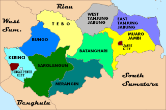
PETA MAP JAMBI

Administrative Divisions : 2 cities & 9 regencies

Cities (2) :

1. Kota Jambi ( Provincial capital, as well as an autonomous city )

2. Kota Sungai Penuh (used to be the seat of Kerinci regency, now is an autononous city separated from the regency)

Regencies / Kabupaten (9) :

3. MUARO JAMBI ( Sengeti )

4. EAST TANJUNG JABUNG ( Muara Sebak )

5. WEST TANJUNG JABUNG ( Kuala Tungkal )

6. BATANGHARI ( Muara Bulian )

7. MERANGIN ( Bangko )

8. TEBO ( Muaro Tebo )

9. SAROLANGUN ( Kota Sarolangun )

10. BUNGO ( Muaro Bungo )

11.  KERINCI (1956-2011: Sungai Penuh ; 2011-now:  Siulak )

ZIP Code :36-37xxx  Phone Code:  0740 (Mendahara/Muara Sabak); 0741 (Kota Jambi & Sengeti/Muara Jambi);  0742 (Kuala Tungkal/Tebing Tinggi Jambi);  0743  (Muara Bulian); 0744 (Muara Tebo); 0745 (Sarolangun); 0746 (Bangko); 0747 (Muara Bungo); 0748 (Kerinci & Sungai Penuh)

Vehicle Plate : BH (all province)

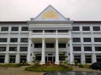
State University :

university jambi 2

Jambi State Univ (Univ. Negeri Jambi / UNJA) – Kampus Pinang Masak, Kota Jambi

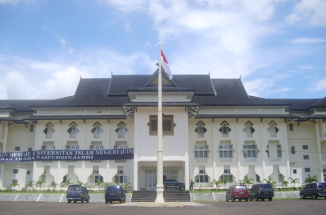
iain sultan thaha

Sultan Thaha Saifuddin State Islamic Institute (IAIN STS) –  Telanai Pura, Kota Jambi

Airports:

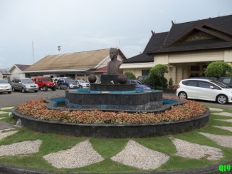
sulanthaha jambi airport

Sultan Thaha Airport / DJB  (Jambi city)

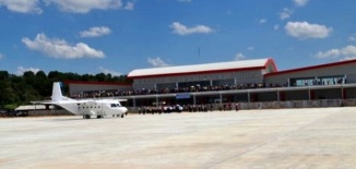
Bandara-Muara-Bungo_zps43f3650b

Muaro Bungo Airport (Muaro Bungo city, Bungo)

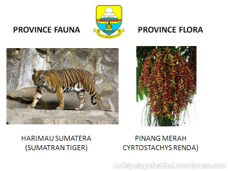
Province Fauna/Floral:

jambi flora fauna

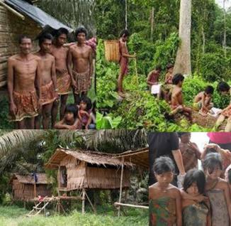
Ethnics of origin: Malays (Melayu Jambi); Kerinci; Native people (Sakai, Rimbo)

anak dalam rimba2

Native people of Jambi, the forest-nomad Anak Dalam (Orang Rimba)

Food: Jambi culinaries are influenced by Arab-India, Chinese and Malays/Minangkabaus. Some Palembang specialties are also common here such as Pindang ikan, Empek-empek, Tekwan, Tempoyak.


Folksong:  Injit-injit Semut, Pinang Mudo, Mak Inang, Tanduklah Lancip, Batanghari, Angso Duo, Rang Kayo Itam.

Dance-art:

Traditional Clothes:

Traditional weapon 

Traditional house :

kjglako pg jambi

Jambi Malays Traditional ‘Kajang Lako’ & ‘Panggung’ house

Downtown & Mall :

Port :

Rivers :  Batang Hari, Batang Asam, Batang Tembesi, Bulian, Kumpeh, Pengabuan, Serengam, Singkati Gedang.

jambi city

Jambi City is actually a river city, Batang Hari River runs through it

Mountain & Natural :

National Park/Ocean Park :

Bridge & Dam : Aur Duri ( Batanghari I ); Makalam ; Batanghari II
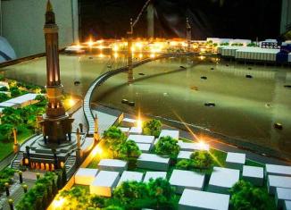
bridge project jambi

Pedestrian Bridge – projected done by the end of 2014 for tourism, it’ll connect Metropolitan Jambi with Seberang Side (across Btanghari River) where Old Malay Jambi villages exist.  

Places of Interest :  *Historical Tourism, including : *Religious Tourism, including :  *Adventure Tourism : *Shopping Tourism : (handicrafts as well as many Malaysian & Singaporean products)

Visit : Pics of Provincial Capitol & Landmarks (click here):

Official Map:

Photos credit: Balaputradewa, Skyscrapercity.com

West Sulawesi Province

Official Name : Sulawesi Barat (Abbreviation: Sul-Bar) ; Origin of Name : ‘
History :

Founded : 4 August 1950

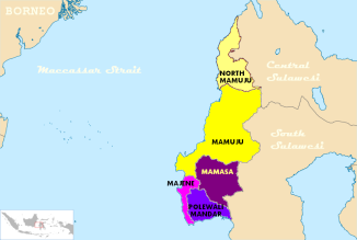
Location : Previously part of South Sulawesi Province, secluded as new province consisted five regencies that lay on the western part of southern/central sulawesi. Bordering Maccassar Strait, Central Sulawesi (Donggala) and bounded by its former province (South Sulawesi) : North Toraja, Tana Toraja & Pinrang.

Capital : Mamuju City ( Provincial capital as well as regency capital )

Pop:  / Area:

Province Seal :  Motto :

SULBAR MAP PETA
Administrative Regions : 5 Regencies – None any autonomous city

1. MAJENE ( Majene City )

2. POLEWALI-MANDAR ( Polewali )

3. MAMASA ( Mamasa City )

4. MAMUJU ( Mamuju City )

5. NORTH MAMUJU ( Pasang Kayu )

ZIP Code : / Phone Code:

State University:

Airports:

Province Fauna/Floral:

Ethnic/Language of Origin:

Food:

Folksong:  Dance-art:


Traditional Clothes:


Traditional weapon :

Traditional house :

Downtown & Malls:


Port :

Rivers, Mountain & Natural :

National Park/Ocean Park :

Bridge & Dam :

Places of Interest :  *Historical Tourism, including : *Religious Tourism, including :  *Adventure Tourism : *Shopping Tourism :

Visit : Pics of Provincial Capitol & Landmarks (click here):

Official Map:

Central Kalimantan Province

Official Name : Kalimantan Tengah (Abbreviation: Kal-Teng) ; Origin of Name : ‘Kalimantan’ is Indonesian (and locals) name of ‘Borneo’. Although many theories exist about its origin, one is from the Indian approach. ‘Kalimantan’ which is often spelled ‘Klemantan’ is derived from Sanskrit : “Kalamanthana” or burning weather island (or island that is very hot temperature). It consists of two words ‘kal[a] : season, period’ and ‘manthan[a] : burning’. But the words “Kalamanthana’ is spelled Kalmantan. And the indigineous people fixed it into Klemantan.

‘Tengah’ means ‘central’, thus ‘Kalimantan Tengah’ refers to ‘Central part of Kalimantan’

History :

Founded : 1956 (prior that was part of Kalimantan Province from 1945-1956, capital in Banjarmasin)

Location : North-Eastern part of Kalimantan. Along Makassar Strait. Bordering Malaysia’s Sabah (Tawau, Nabawan & Sipitang), Malaysia’s Sarawak (Kapit, Limbang & Miri), Central Kalimantan (Murung Raya & Barito Utara), West Kalimantan (Sintang & Kapuas Hulu) & South Kalimantan (Tabalong, Balangan & Kota Baru Daratan).

Capital :

Pop: / Area:

Province Seal :  Motto :

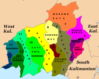
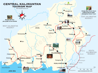
Kalteng Peta Central kalimantan map

Administrative Divisions : 1 city/ 13 Regencies (Municipals):name (its capital) -see the chart with coresponding number-

1. Palangka Raya City (provincial capital)

2. PULANG PISAU (Pulang Pisau City)

3. KAPUAS (Kuala Kapuas)

4. SOUTH BARITO (Buntok)

5. EAST BARITO (Tamiang Layang)

6. NORTH BARITO (Muara Teweh)

7. MURUNG RAYA (Purukcahu)

8. GUNUNG MAS (Kuala Kurun)

9. KATINGAN (Kasongan)

10.EAST KOTAWARINGIN (Sampit)

11.SERUYAN (Kuala Pembuang)

12.WEST KOTAWARINGIN (Pangkalan Bun)

13.LAMANDAU (Nanga Bulik)

14.SUKAMARA (Sukamara City)

ZIP Code :/ Phone Code:  Vehicle Plate :

State University:

Airports:

Province Fauna/Floral:

Ethnics of origin: / Language:

Food: /  Folksong:  Dance-art:

Traditional Clothes:

Traditional weapon : Dayak’s sumpit & Mandau; Coastal Malay’s kris

Traditional house : Typical Dayak’s house is called Rumah Lamin. It’s a long house where many related families live together.

Downtown & Mall :


Rivers, Mountain & Natural :

National Park/Ocean Park :

Bridge & Dam :

Places of Interest :  *Historical Tourism, including : *Religious Tourism, including :  *Adventure Tourism : *Shopping Tourism : (handicrafts as well as many Malaysian & Singaporean products)

Visit : Pics of Provincial Capitol & Landmarks (click here):

Official Map:

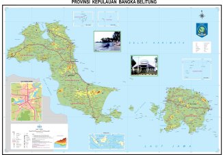
Bangka-Belitung Archipelago Province

Official Name : Kepulauan Bangka Belitung (Abbreviation: Babel ) ; Origin of Name :

History :

Founded :

Location :

Capital : Pangkal Pinang City ( )

Pop: / Area:

Province Seal : Motto :

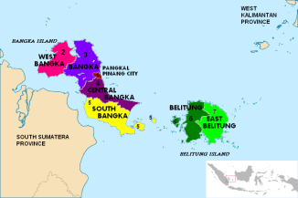
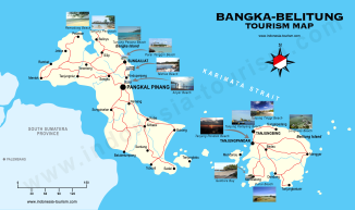
BABEL PETA MAP

Administrative Divisions : 1 Autonomous city (Kota)/ 6 Regencies /Municipals (Kabupaten):name (its capital) -see the chart with coresponding number-

1. Kota Pangkal Pinang (autonomous city as well as provincial capital)

2. WEST BANGKA (Muntok)

3. BANGKA (Sungai Liat)

4. CENTRAL BANGKA (Koba)

5. SOUTH BANGA (Toboali)

6. BELITUNG (Tanjung Pandan)

7. EAST BELITUNG (Manggar)

ZIP Code :/ Phone Code: Vehicle Plate : (all province)

State University:


Airports:


Province Fauna/Floral:

Ethnics of origin:

Food:   Folksong:  Dance-art:

Traditional Clothes:

Traditional weapon :

Traditional house :

Downtown & Mall :

Rivers, Mountain & Natural :

National Park/Ocean Park :

Bridge & Dam :

Places of Interest :  *Historical Tourism, including : *Religious Tourism, including :  *Adventure Tourism : *Shopping Tourism : (handicrafts as well as many Malaysian & Singaporean products)

Visit : Pics of Provincial Capitol & Landmarks (click here):

Official Map:

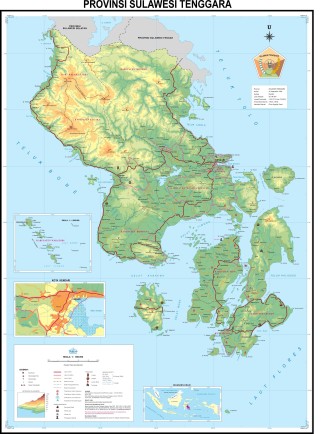
South-East Sulawesi Province

Official Name : Sulawesi Tenggara (Abbreviation: Sul-Tra ) ; Origin of Name :

History :

Founded :

Location :

Capital : Kendari City (KDR)

Pop: / Area:

Province Seal :  Motto :

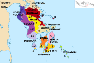
Administrative Divisions : 2 Autonomous Cities (Kota)/ 10 Regencies/Municipals (Kabupaten):

sultra southeast sulawesi map peta

1. Kendari City (provincial capital)

2. Bau-bau City

3. BUTON (Buton City)

4. NORTH BUTON (Buranga)

5. MUNA (Raha)

6. WAKATOBI (Wangi-wangi)

7. KONAWE (Umaaha)

8. NORTH KONAWE (Asera)

9. SOUTH KONAWE (Anolo)

10. KOLAKA (Kolaka City)

11. NORTH KOLAKA (Lasusua)

12. BOMBANA (Rumbia)

ZIP Code :/ Phone Code: / Vehicle Plate :

State University:

Airports:


Province Fauna/Floral:

Ethnics of origin:

Food: /  Folksong: Indung-indung (Berau) Dance-art:

.

Traditional Clothes: Dayak outfit & Kutai’s baju adat

Traditional weapon :

Traditional house : .

Downtown & Mall :


Rivers, Mountain & Natural :

National Park/Ocean Park :

Bridge & Dam :

Places of Interest :  *Historical Tourism, including : *Religious Tourism, including :  *Adventure Tourism : *Shopping Tourism : (handicrafts as well as many Malaysian & Singaporean products)

Visit : Pics of Provincial Capitol & Landmarks (click here):

Official Map:

Central Java Province

Official Name : Jawa Tengah (Abbreviation: Ja-Teng) ; Origin of Name : ‘

History :

Founded : 4 August 1950

Location :

Capital :

Pop:  / Area: ()

Province Seal :  Motto :


Administrative Divisions: 
6 Autonomous Cities (Kota) & 29 Regencies (Kabupaten); grouped into 6 governorate assistance regions:

* KEDU REGION GOVERNORATE ASSISTANCE :

consists of 1 autonomous city (kota) and 5 regencies (kabupaten);the vehicle plat is AA

1. Magelang City

2. MAGELANG Regency (Kota Mungkid)

3. TEMANGGUNG (Temanggung City)

4. WONOSOBO (Wonosobo City)

5. KEBUMEN (Kebumen City)

6. PURWOREJO (Purworejo City)

* BANYUMAS REGION GOVERNORATE ASSISTANCE :

consists 4 regencies (kabupaten), and have their vehicle plat ‘R‘:

1. BANYUMAS (Purwokerto)

2. CILACAP (Cilacap City) -includes Nusa Kambangan Island

3. PURBALINGGA (Purbalingga City)

4. BANJARNEGARA (Banjarnegara City)

* SURAKARTA REGION GOVERNORATE ASSISTANCE :

consists 1 Autonomous city and 6 regencies (kabupaten), these are the former reigned land of the Surakarta Hadiningrat Sultanate. It has vehicle plat ‘AD‘:

1. Kota Surakarta / Solo

2. KARANGANYAR (Karanganyar City) 

3. SRAGEN (used to be SUKOWATI) (Sragen City)

4. SUKOHARJO (Banjarnegara City)

5. KLATEN (Klaten City)

6. BOYOLALI (Boyolali City)

7. WONOGIRI (Wonogiri City)

* SEMARANG REGION GOVERNORATE ASSISTANCE :

consists 2 Autonomous cities and 3 regencies (kabupaten), and has vehicle plat ‘H‘:

1. Kota Semarang

2. Kota Salatiga

3. SEMARANG Regency (Ungaran)

4. DEMAK (Demak City)

5. KENDAL (Kendal City)

* PEKALONGAN REGION GOVERNORATE ASSISTANCE :

consists 2 Autonomous cities and 5 regencies (kabupaten), and has vehicle plat ‘G‘:

1. Kota Pekalongan

2. Kota Tegal

3. PEKALONGAN Regency (Kajen)

4. TEGAL Regency (Slawi)

5. BREBES (Brebes City)

6. PEMALANG (Pemalang City)

7. BATANG (Batang City)

PATI REGION GOVERNORATE ASSISTANCE :

consists 6 regencies (kabupaten), and has vehicle plat ‘K‘:

1. PATI (Pati City)

2. KUDUS (Kudus City)

3. JEPARA (Jepara City)

4. REMBANG (Rembang City)

5. BLORA (Blora City)

6. GROBOGAN (Purwodadi)

ZIP Code :70-72xxx/ Phone Code: 021

State University:

Airports:

Province Fauna/Floral:

Ethnic/Language of Origin:

Food:

Folksong:  Dance-art:

Traditional Clothes:

Traditional weapon :

Traditional house :

Downtown & Malls:

Port :

Rivers, Mountain & Natural :

National Park/Ocean Park :

Bridge & Dam :

Places of Interest :  *Historical Tourism, including : *Religious Tourism, including :  *Adventure Tourism : *Shopping Tourism :

Visit : Pics of Provincial Capitol & Landmarks (click here):

Official Map:

Bengkulu Province

Fort Marlborough, Bengkulu City -a historical heritage of British colonization circa 1710s *Previous iconic pic: Annual Tabot festival in Bengkulu held during 1-10 Muharram every year

Official Name : Bengkulu (Abbreviation: BKU).  Previously in the past: Bencoolen Origin of Name : Probably from the word ‘Bangka Hulu’ or ‘Bangka Ulu’ (upstream Bangka).

History : If anything the rest of Sumatra and for the most part of Indonesia was under Dutch East Indies, then Bengkulu was the lone exception that it belonged to British (English East India) until Anglo-Dutch Treaty in 1824 .  So Raffles was here and did other British governors as well as  monuments, forts and etc.

This south-west Sumatran part was never under any big local patronage as of neighboring Palembang or Jambi Sultanates.  There were only few smalls ‘kedatuan’ based on ethnicity such as in  Sungai Serut,  Selebar,  Pat Petulai, Balai Buntar, Sungai Lemau, Sekiris, Gedung Agung and Marau Riang.  It was then once a vassal region of  Banten Sultanate (from Western Java) and since 17th century was ruled by Minangkabau’s Inderapura Sultanate (today’s in Pesisir Selatan, West Sumatra Province).

In the early Independence, Bengkulu was included in the Older ‘South Sumatera’ Province with Lampung, Bangka-Belitung Archipelago and rest of South Sumatera itself, as a Residency).  It finally gained its provincial status in 1968 as the 26th province (prior to the last province: East Timor). ’27’ was the famous number of provinces (27 provinces) during New Order Regime which would last for the next thirty years until 1998,  as of today the number of administrative region has expanded rapidly (34 provinces, with East Timor eventually gains its independence).

Founded : 18 November 1968

Legality :  UU No. 9/1967 Junkto Peraturan Pemerintah No. 20/1968

Location :  Bengkulu lies in the western side of southern Sumatera Island,  including Enggano Island off the coast.  It borders Provinces:  West Sumatera (Pesisir Selatan);   Jambi (Kerinci & Sarolangun);   South Sumatera ( Musi Rawas, Lubuk Linggau City, Empat Lawang, Lahat, Pagar Alam, Muara Enim & South OKU );  and  Lampung ( Lampung Barat & Pesisir Barat).  It also borders  Indian Ocean  (Samudera Hindia).

Capital : Bengkulu City

Pop: 1,665,314 (27th)/ Area: 19,919 km2 (23th)

Province Seal :

PROV BKU

Motto : None officially. But some Bengkulu Malays proverb used, includes : “Sekundang setungguan seio sekato”  (together we stand); “Ke bukit Samo Mendaki, Ke lurah Samo Menurun, Yang Berat Samo Dipikul, Yang Ringan Samo Dijinjing”; “Bulek Air Kek Pembukuh, Bulek Kata Rek Sepakat”.

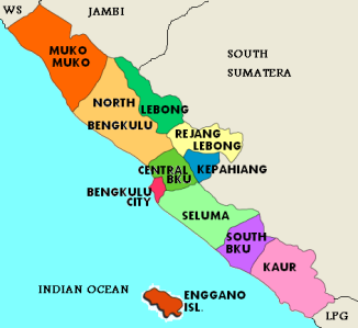
PETA MAP BENGKULU

Administrative Divisions : 1 Autonomous city (Kota)/ 10 Regencies (Municipals/Kabupaten):

1. Kota Bengkulu (Autonomous city as well as provincial capital)

2. MUKO-MUKO  ( Muko-muko city )

3. NORTH BENGKULU  ( Arga Makmur ) – including Enggano Island

4. LEBONG  ( Muara Aman 2003-2012;  Tubei 2012-now )

5. REJANG LEBONG  ( Curup )

6. KEPAHIANG  ( Kepahiang city )

7. CENTRAL BENGKULU  ( Karang Tinggi )

8. SELUMA  ( Tais )

9. SOUTH BENGKULU  ( Manna )

10.KAUR  ( Bintuhan )

ZIP Code : 38-3977xxx  Phone Code: 0763 (Bengkulu); 0732 (Curup/Rejang Lebong); 0737 (Arga Makmur, Muko-Muko); 0738 (Muara Aman/Lebong); 0739 (Bintuhan/Kaur , Manna) Vehicle Plate : BD (all province)

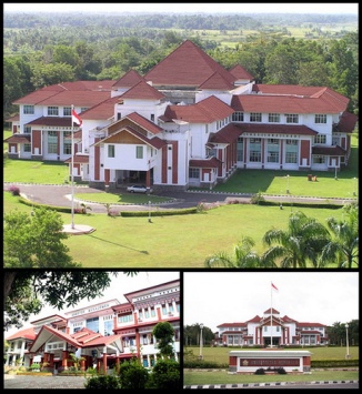
State University: Bengkulu State Univ /UNIB (Kandang Limun, Bengkulu City); Bengkulu Islamic Univ/STAIN BKU (Bengkulu City).

unib

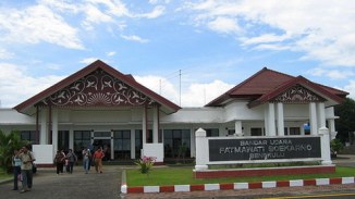
Airports: Fatmawati Soekarno Airport (BKS) – named after first lady of the first president who hailed from the province, previously the airport was named ‘Padang Kemiling Airport’.

Bandara-udara-Fatmawati-Soekarno-Bengkulu

Ethnics of origin:  Rejang,  Serawai,  Melayu Bengkulu,  Lembak,  Enggano

epri1

Languages of origin:  Bahasa Rejang,  Baso Melayu Bengkulu (mix of Minang and Palembang/Jambi),  Pekal, Lembak, Kaur,  Pesemah,  Serawai,  Native language of Enggano.

800px-rejang_alphabet

The Redjang or Kaganga alphabet is descended ultimately from the from Brahmi script of ancient India by way of the Pallava and Old Kawi scripts.  Redjang is a syllabic alphabet – each letter has an inherent vowel /a/. Other vowels can be indicated using a variety of diacritics which appear above or below the consonants. The Redjang alphabet is used mainly to write magic spells and medical incantations and some poetry. Rejang Alphabet known as Kaganga Alphabet. It just not used by Rejang People (Bengkulu Province) but also used by Lampung People and Kerinci People (Jambi Province).

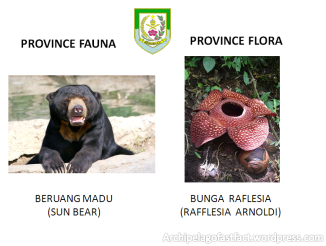
Province Fauna/Flora:

flora fauna

Food:

food

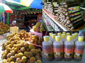
Durian is abundant here – Lempuk Durian (Dodol) – Kalamansi Syrup

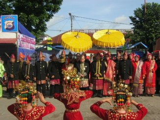
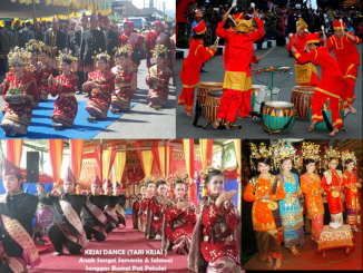
Dance-art : Rejang Dances (Kejei Semulan Dance, Anok Sangei Dance), Bidadari Teminang Anak, Andun, Penyambutan/Sekapur Sirih, Putri Gading Cempaka, Pukek (Pukat)

Dance-art : Dul (Music Ensemble), Geritan, Serambeak, Andi-andi, Sambei

Traditional Songs : Langgam Melayu Bengkulu & Lagu-lagu Rejang ( Lalan Balek, Taneak Tanai, Anak Kunang, Beinai Curi, Bedindang, Ibo)

dances

Persembahan Dance –  Dul Ensemble – Colorful Baju Kurungs – Kejai Rejang Dance

Traditional Clothes:

dress

Bengkulu outfits ( consist of two types: the Malays & the Rejangs )

Presiden_SBY_pakai_Batik_Besurek

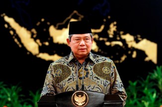
Kain Besurek –  (Bengkulu style of Batik with Islamic motif), worn by President SBY

Traditional weapon : Keris Bengkulu

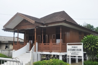
Traditional house : Pusako Bubung Limo (Panggung)

fatmawati hous

First lady’s house (Ibu Fatmawati Soekarno) which is a typical Bengkulu Panggung house, now’s a museum in Bengkulu City

BEACH :  Panjang, Pasir Putih, Tapak Paderi, Jakat, Tanah Lot Lais

ISLAND : Enggano, Tikus

LAKE : Dendam Tak Sudah, Tes, Gedang, Mas Harun Bastari, Musi, Picung Tubei Lebong, Pematang Curup, Tabarena Curup Natural Pools

PORT : Pulau Baii Port

NATIONAL PARK : Kerinci-Seblat Natl. Park, Taman Hutan Tropis Tahura, Seblat Hunting Park, Konak Park, Enggano Island Nanu’ua Park, Dio Bagito Zoo Park

OCEAN PARK : Enggano Island

RIVER : Seblat River, Ketahun River

HOT SPRINGS : Tujuh Warna Rimbo Penggadang, Suban Curup, Air Putih Muara Aman

WATERFALL : Suban Curup, Kepala Curup

ELEPHANT TRAINING : Seblat, Napal Putih

MOUNTAIN: Gunung Kaba Curup

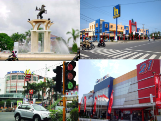
Downtown & Malls :

downtown

Places of Interest : 

exile house soekarno

Bung Karno Exile House (imprisonment by the Dutch in the early 1930s)

Masjid-Jamik-Bengkulu-2

Masjid Jamik Bengkulu, Classic icon in the heart of the city

Masjid_Akbar_At_taqwa_Bengkulu_by_bengsin

Masjid At-Taqwa

1_Fort_Marlborough_Bengkulu_A

Marlborough Fort

thomas parr mon

Thomas Parr Monument

51b5716e-8fac-4b83-9858-4d53ca2ba9b3

 Dendam Tak Sudah Lake ; Panjang Beach; Tapak Paderi Beach

pulau enggano2

Enggano Island Adventures (Wild life, native people & Beach surfing)

Festival :

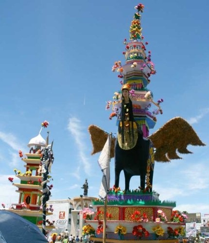
tabot

Annual Tabot Festival, Bengkulu City

It’s a religious festival in honour of  Prophet Muhammad’s grandsons Hassan & Hussein who were killed in the Karbala.  It has been held since 15th century introduced by Syekh Burhanuddin. Procession held anually between 1 to 10 Muharram i.e : “Upacara Mengambil Tanah” ( literally ‘pick sacred ground’ held on the night prior to 1 Muharram); “Duduk Penja” ( sitting and pray ceremony between 4 and 5 Muharram); “Menjara Ceremony” (5 – 6 of Muharram);  “Anak Jari-Jari dan Seroban” ceremony (7 – 8 Muharram); “Arak Gedang” (This is the most interesting part as Tabuts were paraded around the city on 9 Muharram) and the closing ceremony ” Tabut Tebuang” where the tabuts were casted off to the sea on 10 Muharram.

Official Map:

Photo credits:

Skyscraper.com (Balaputradewa) and other sources